

Parcel for Sale
reference: 1065
Basic Plot Information
-
Name: “Kako Akrotiri”
-
Total Area: 16,589.47 sq.m.
-
Coordinate System: Hellenic Grid (EGSA ’87)
-
Survey Method: GPS survey using the Greek Positioning System URANUS
-
Location: Outside the limits of any settlement and outside the Urban Control Zone (Z.O.E.)
-
Distance from the sea: 45.00 m
-
Distance from the nearest settlement (Koronida): 5,290.00 m
Engineer’s Declaration (Law 651/77)
The undersigned engineer hereby certifies that:
-
The plot is complete and buildable with respect to its area and dimensions.
-
It lies outside settlement boundaries and outside the Urban Control Zone (Z.O.E.).
-
It does not fall under the provisions of Law 1337/1983 regarding land and monetary contributions.
-
There are no overhead high-voltage power lines of the Public Power Corporation (DEH) and no natural gas pipelines crossing the plot.
-
No trees exist along the plot’s frontage.
-
No stream passes within a distance of less than 20.00 m from the plot.
Remarks
-
The topographic diagram is referenced to the official coordinate system EGSA ’87.
-
The dimensions and total area have been calculated analytically from the coordinates of the plot’s vertices.
-
The geodetic reference was established through a GPS survey using the URANUS Greek Positioning System.
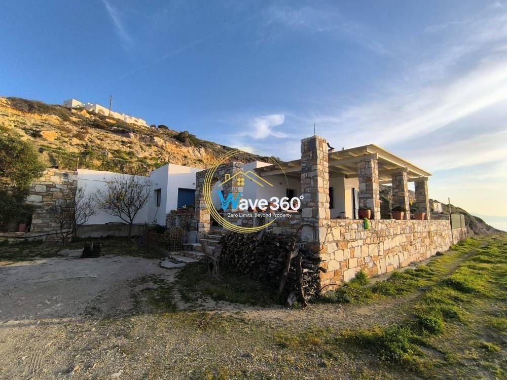
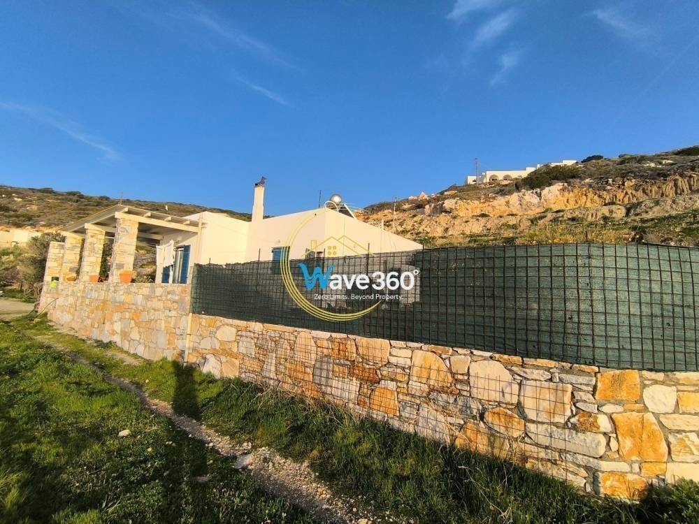
Buildings and Structures
-
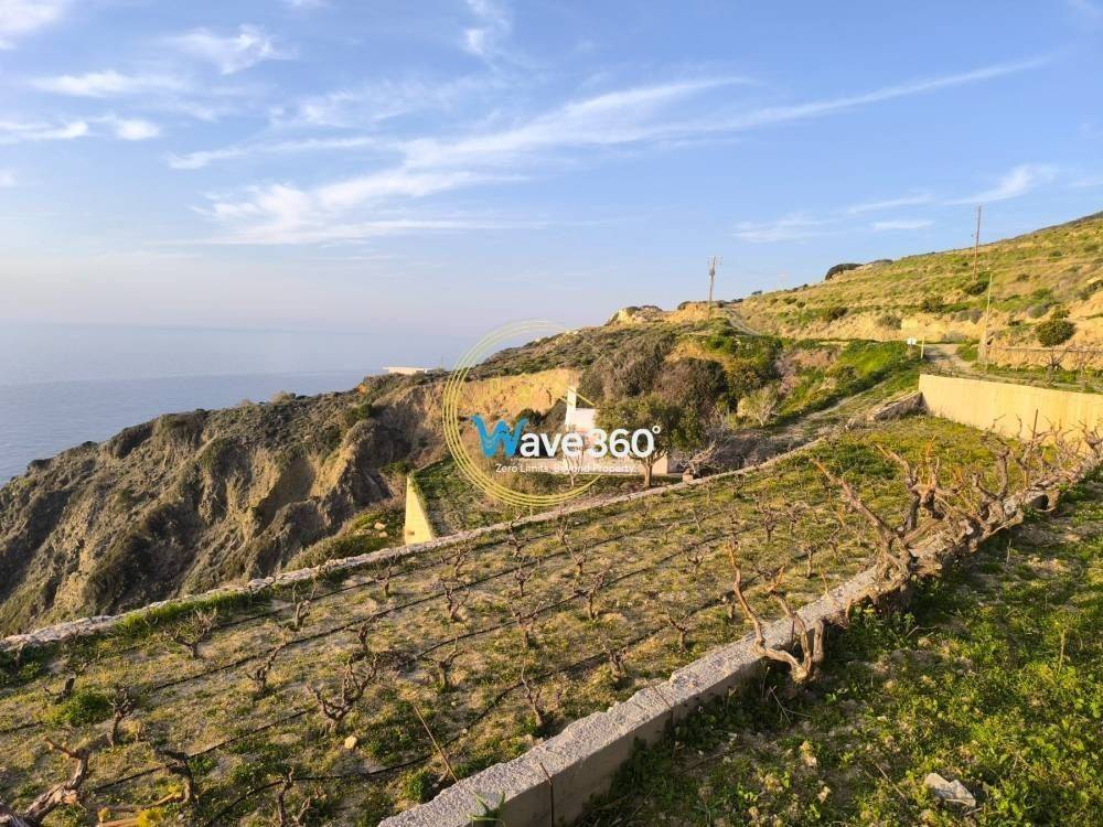
Ground-floor structure (storage building): Area = 88.23 sq.m. — pre-existing before 1974
-
Ground-floor structure (storage building): Area = 14.89 sq.m. — lacking building permit
-
Ground-floor structure (storage building): Total = 117.51 sq.m., E1 = 68.50 sq.m. — according to Building Permit
Additionally, a private chapel (Holy Temple) exists within the plot boundaries.
Coastal Zone
A coastal boundary line (P.O.A.) is in place, as defined by Government Gazette 452/D’ / 30.10.2018.
DESCRIPTION AND DEVELOPMENT POTENTIAL
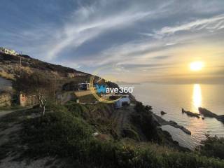
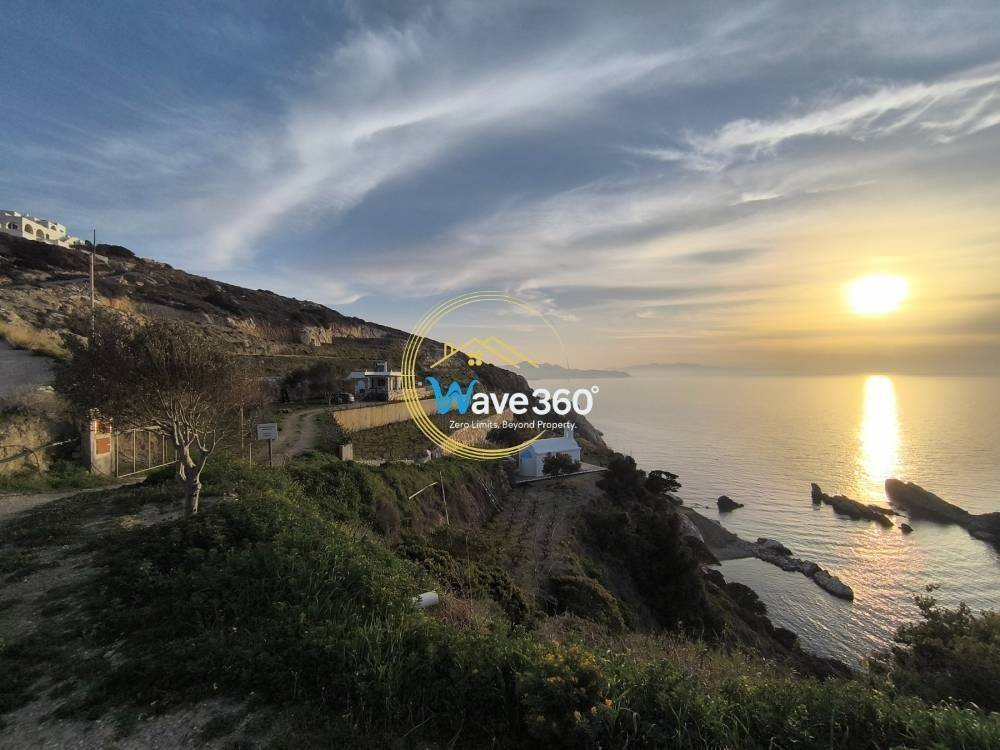
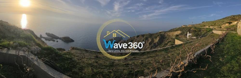
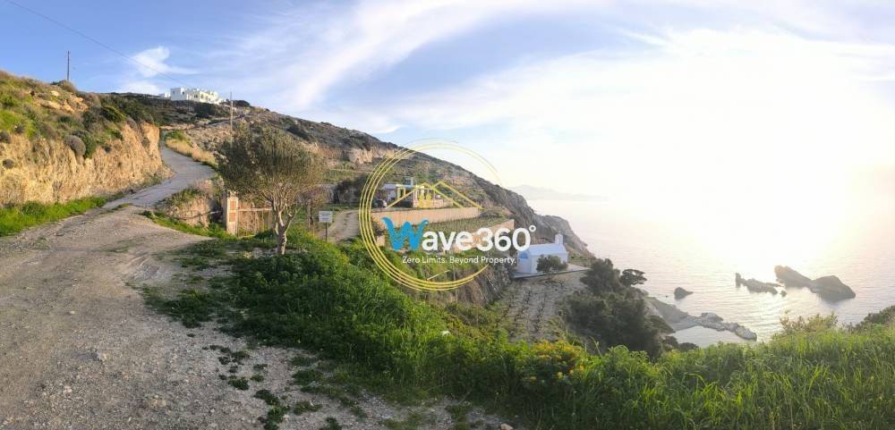
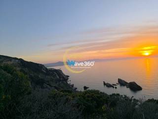
The property, with a total surface area of 16,589.47 sq.m., is located at the area known as “Kako Akrotiri”, within the Local Community of Koronida, Municipal Unit of Naxos, Municipality of Naxos and Small Cyclades.
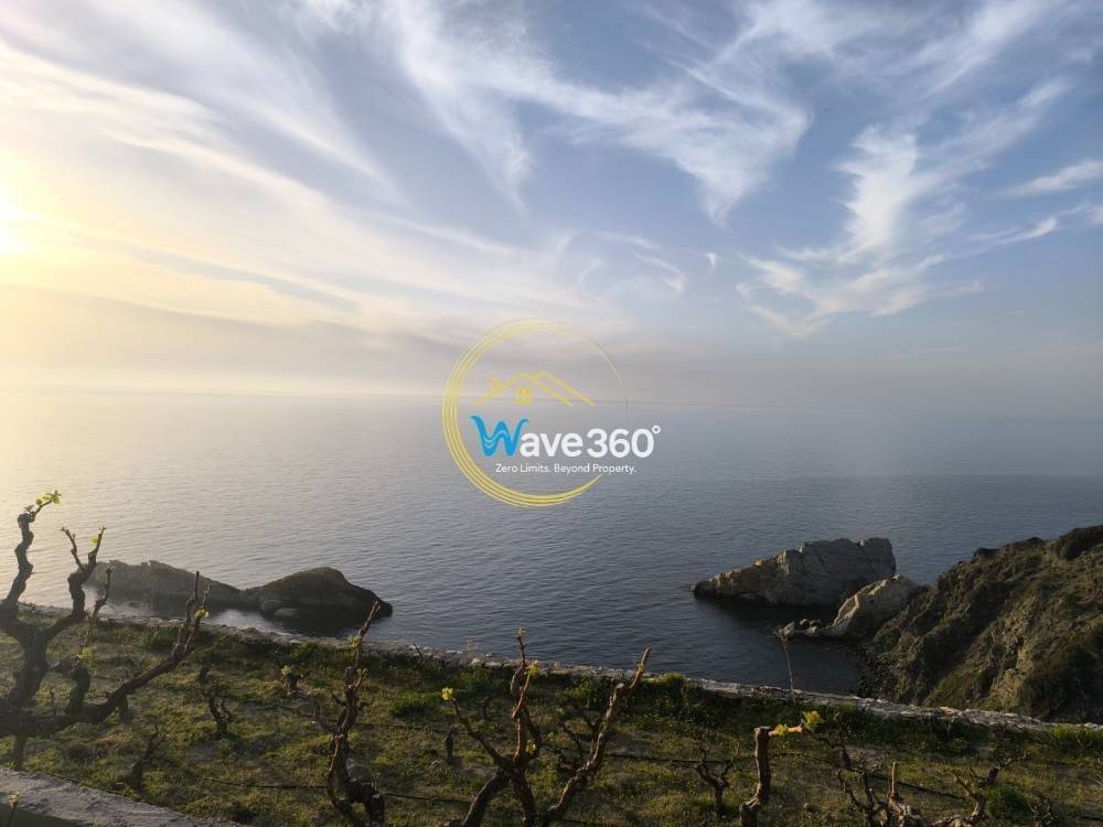
It is a seaside, amphitheatrical and exceptionally privileged plot, featuring direct frontage to the sea and a natural formation that creates a private natural harbor, providing direct and safe marine access for small and medium-sized vessels.
The property is situated approximately 18 km from Naxos Town (Chora) and the island’s main port, easily accessible via asphalt road, while maintaining absolute privacy and unobstructed panoramic views of the Aegean Sea.
Planning and Building Data
The land parcel is complete and buildable according to current planning regulations for out-of-plan areas of Naxos.
Based on the permitted building coefficient for tourist accommodation (0.18), the following parameters apply:
-
Maximum Buildable Area:
16,589.47 sq.m. × 0.18 = 2,985.00 sq.m. -
Maximum Coverage:
16,589.47 sq.m. × 0.18 = 2,985.00 sq.m.
Hotel Development Potential
The property meets all legal and physical criteria for the issuance of a building permit for a hotel or tourist accommodation complex, as:
-
It constitutes a single, continuous plot exceeding 15,000 sq.m.
-
It has frontage on a public agricultural road.
-
It is located outside settlement boundaries and Urban Control Zones (Z.O.E.).
-
It does not fall within NATURA 2000 or archaeological protection zones.
-
It enjoys direct sea access with a natural private waterfront, offering exceptional conditions for the development of a boutique resort, luxury villa complex, or eco-lodge.
Environment and Investment Outlook
The site lies within a pristine natural landscape with gentle slopes and a southern orientation, ensuring 180° unobstructed views of the Aegean Sea and the surrounding islands.
The natural cove serves as a protected anchorage, a rare and valuable feature among coastal properties of Naxos.
Due to its location and morphology, the property is ideal for a high-end tourism investment, with eligibility for inclusion in Greek investment incentive schemes (ESPA, Development Law, or “Go Green” Program), and potential for the creation of a private marina or small-scale dock, subject to the required approvals.

- Contract
- Sale | Income property
- Type
- Parcel
- Surface
- 16,500 m²
- Street access / right of way
- On a dirt road
- Exposure west
- Price
- € 1,500,000
- Price per m²
- 91 €/m²