1/1
Want more photos?
Request photos from the advertiserLand Plot for Sale
€ 920,000
Listing updated on 11/06/2025
Description
reference: EK-9876399
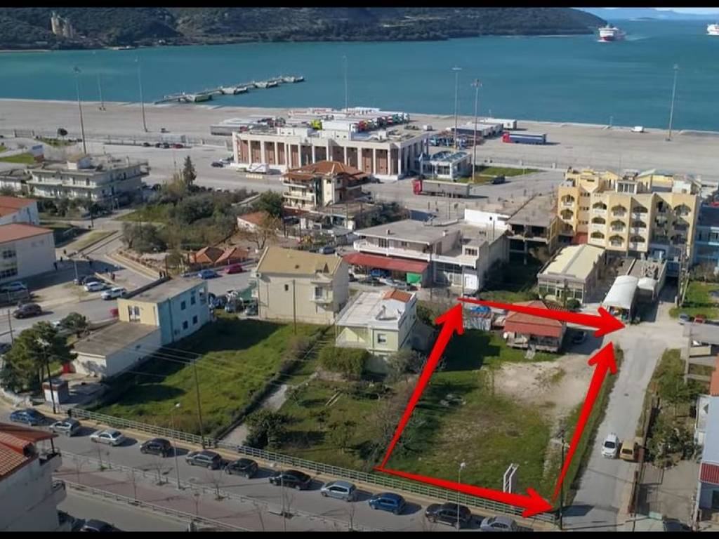
This is plot number (1), at 54 OT, which contains a ground-floor house with an area of 63.75 m2 and a ground-floor warehouse (with sheet metal) with an area of 18.00 m2. According to the topographic diagram from December 1996 by civil engineer Ioannis Kiochos, it has an area of 1,429.63 m2 and is even and buildable, bordered all around by a pedestrian walkway on the side (A-B) of 9.00 m in length and on the side (B-C) of 23.00 m in length, by the property of Zoi on the side (C-D) of 5.00 m in length and on the side (D-E) of 54.50 m in length, by Parga Street (today called 49 Martyron) on the side (E-X) of 21.00 m in length and finally by a pedestrian walkway on the side (X-A) of 50.50 m in length. The plot in question was part of a larger plot of total area of 2,954.79 m2 which, after the implementation of the city plan of Igoumenitsa (1st Urban Planning Unit – Ladochori) consisted of two properties. The assessed one has a slight slope, a shape that tends to be trapezoidal, an earthy substrate and is fenced with metal posts and wire mesh.
Features
- Contract
- Sale | Income property
- Type
- Land Plot
- Surface
- 1,429 m²
- Street access / right of way
- On the motorway
Other features
- Exposure east
Price information
- Price
- € 920,000
- Price per m²
- 644 €/m²
Advertiser

Private person
Additional options
Private person